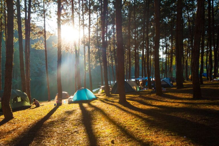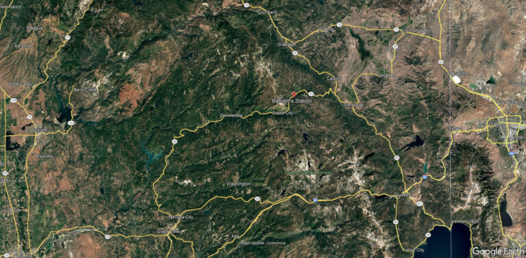
Experience the majestic beauty of Frazier Falls or the panoramic view of the Mohawk Valley from the Sierra Buttes Fire Lookout. There are miles and miles of hiking trails waiting for you to explore each one. Before you venture out, stop by Bassett’s Station and take a look at our hiking maps and guide books. In the meantime, here are few popular hikes to get you started.
Sierra Buttes Fire Lookout Trail
There are a few ways to get to the Sierra Buttes Lookout. One trailhead is located off Packer Lake Road. From here it is about 5 miles and is generally considered a challenging hike. It takes around 3 hours to complete and the elevation gain is 1,545 ft. To get there from Bassett’s, take Gold Lake Road toward Graeagle for about a mile and turn left on Packer Lake Road. Follow the signs to Packer until you get to Co Rte 621 marked with a sign reading “Sierra Buttes”. Packer Saddle is the first parking lot. Turn left on Butcher Ranch Road and keep left for another half mile. The trailhead has a wide dirt area and is marked with trail signs.
The second trailhead takes you closer to the lookout. Take Sierra Buttes Road in Sierra City on the left as you drive from Downieville toward Bassett’s. Continue on Forest Road 93 until you reach the 93-2 Road intersection. Follow 93-2 Rd for about 0.25 miles and you’ll find a parking area on the left next to a green gate. This parking area is on Sierra Land Trust land, and there is an information bulletin board at the trailhead. The best time to hike it is June to October. Dogs must be on a leash.
Frazier Falls
The stream’s vertical drop is 176 feet and well worth the short hike to see it. From Bassett’s Station, take Gold Lake Highway toward Graeagle and continue for around 7 miles until you see a sign on the right for “Frazier Falls”. Continue down this road, Frazier Creek Road, for about 4 miles to the parking lot. It’s an easy 1 mile hike round trip and very popular.
Sardine Lakes Trail
And easy hike for all the family, it takes on average about half an hour to complete.
Robinson Cow Camp Loop
Take a walk to the old ghost cow camp where Tim’s great grandmother, Olive, stayed with her cowboys and cattle during the grazing months. It’s a bit spooky but the site is pretty neat to visit. To get to the trailhead,
LakeBasinMap-1More hiking info can be found on the Sierra County Chamber of Commerce website: https://sierracountychamber.com/page-18144
Know before you go
Whether you’re going for a short hike or planning an extended trek, it’s a good idea to start by planning. Here are a few quick tips and reminders.
- Make a gear list: REI has a great Backpacking Checklist
- Hydration: Carry plenty of clean water or invest in a water filtration/purification system
- Tell someone: 1) Where you’re going, 2) When you plan to return and 3) Who to contact if you’re not back when you said you would be.
- Beware of ticks and other biting insects: Carry repellent and wear the proper clothing
- Sun protection: Sunglasses, hats, lip balm, sunscreen
- Snack and food: granola, dried fruit, trail mix, protein bars for the short day trips
- Going off-grid: Cell signal coverage is spotty at best in Sierra County. Start with buying a map, compass and portable cell phone charger – among other things. For extended trips, consider getting a Personal Locator Beacon (PLB) or Satellite Messenger
- Check the weather before you go
- And if you’re into off-roading, check out these US Forest Service OHV road maps. Click on “Yuba River (North)” to see the service roads in the Lakes Basin area.
Take the time to properly prepare yourself and you’ll enjoy the hiking trip a lot more! And if you forget something, checkout our store. We carry many of the items you’ll need to make your adventure safe and fun.